GPicSync and Flamory
Flamory provides the following integration abilities:
- Create and use advanced snapshots for GPicSync
- Take and edit GPicSync screenshots
- Automatically copy selected text from GPicSync and save it to Flamory history
To automate your day-to-day GPicSync tasks, use the Nekton automation platform. Describe your workflow in plain language, and get it automated using AI.
GPicSync bookmarking
Flamory provides advanced bookmarking for GPicSync. It captures screen, selection, text of the document and other context. You can find this bookmark later using search by document content or looking through thumbnail list.
Screenshot editing
Flamory helps you capture and store screenshots from GPicSync by pressing a single hotkey. It will be saved to a history, so you can continue doing your tasks without interruptions. Later, you can edit the screenshot: crop, resize, add labels and highlights. After that, you can paste the screenshot into any other document or e-mail message.
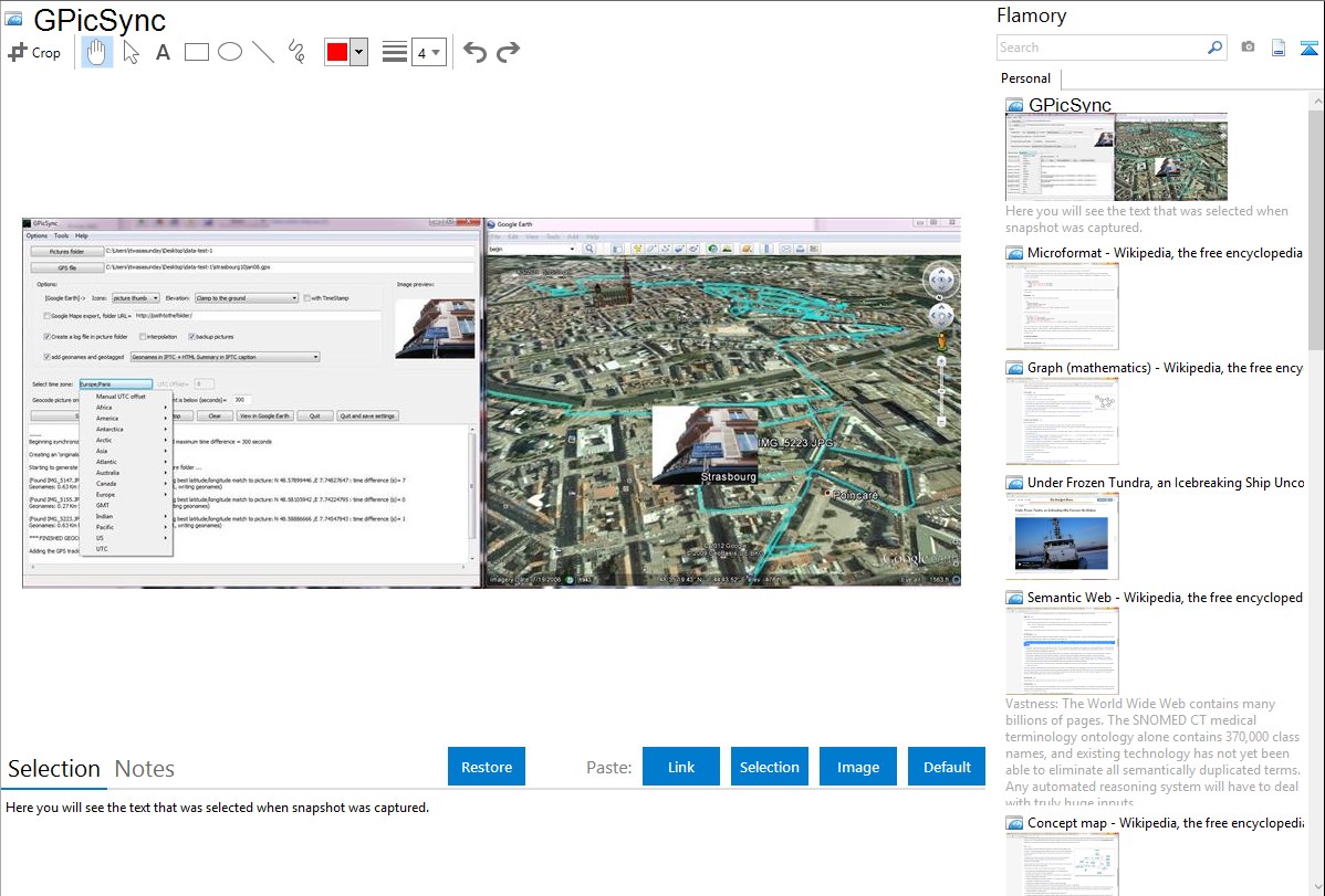
Here is how GPicSync snapshot can look like. Get Flamory and try this on your computer.
Application info
GPicSync automatically inserts location in your photos metadata so they can also be used with any 'geocode aware' application like Picasa/Google Earth, Flickr, loc.alize.us, etc.
Features:
- Automatically geocode your photos (in the EXIF header).
- Use a GPS tracklog in the GPX format or NMEA format (multiple selection possible).
- Support elevation data if present in the tracklog.
- Create a Google Earth KML file to directly visualize the geocoded photos and track in Google Earth.
- Create a Google Maps file to publish your pictures and track on the web.
- Automatically associate audio or video files in Google Earth and Google Maps.
- Create a Google Earth KMZ file (containing your geolocalized pictures and tracklog).
- Add additional geonames and 'geotagged' metadata (for automatic tagging in Flickr for example) and create an automatic IPTC caption.
- manually write latitude/longitude in a picture EXIF or a selection of photos.
- Handy tools integrated (Time correction tool, EXIF reader, GPX inspector, rename pictures with date/location).
- Supports Jpeg pictures and main RAW files format.
- Available in English, French, German, Italian, traditional and simplified Chinese, Catalan, Russian, Spanish, Polish, Portuguese and Czech.
Integration level may vary depending on the application version and other factors. Make sure that user are using recent version of GPicSync. Please contact us if you have different integration experience.